Japanese company Hiro Holdings has partnered with Wise Planning Co. Ltd to use drones for mapping and recreating Japanese historical landmarks in 3D. This innovative approach aims to digitally archive historical buildings and objects as a means of preservation. The use of digital scans is crucial in protecting delicate environments and artifacts from damage caused by over-crowding or over-handling. Additionally, Japan’s ancient wooden structures are highly susceptible to fire damage and erosion, making digital preservation even more essential on the island.
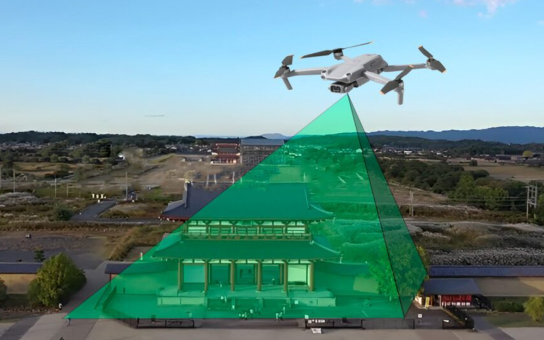
Hiro and Wise intend to employ drone-based photogrammetry to develop detailed 3D models of buildings. They will also utilize smaller camera rigs to create a repository of smaller objects found inside museums. By using LiDAR-equipped 360-degree cameras, the drones will be able to generate highly accurate point-cloud models of cultural properties and landmarks. These models will provide researchers and tourists with access to precise recreations of both the interiors and exteriors of historical buildings, regardless of their location.
Hiro Holdings and Wise Planning will independently operate the flights and handle all video editing and processing themselves. Their goal is to create a new form of digital artifact that benefits Japan by protecting historical environments and enabling risk-free research, as well as appealing to a global audience. This initiative demonstrates significant progress in Japan’s UAV industry as more businesses integrate drones into their workflows to safeguard priceless cultural resources.
For more information, please visit Hiro Holdings’ website (in Japanese).
Sources:
– JUIDA (Japan UAS Industrial Development Association)
– DRONELIFE Staff Writer Ian J. McNabb
Definitions:
– Digital archiving: the process of creating and storing digital scans of historical objects for preservation purposes.
– Photogrammetry: the science of making measurements and creating 3D models using photographs.
– LiDAR: Light Detection and Ranging; a remote sensing method that measures distance using laser light.
– UAVs: Unmanned Aerial Vehicles; commonly referred to as drones.
To reach the Global Drone News editorial team on your feedback, story ideas and pitches, contact us here.