Poladrone, one of Malaysia’s industrial drone company came up with a brilliant initiative to speed up the drone technology adoption in the region.
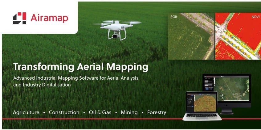
The initiative, Airamap, is an aerial mapping data processing software which aims to cater to the region’s economic industries such as agriculture (namely palm oil), construction and other major industries.
Airamap is to tackle the discrepancies and issues that happened when aerial data captured from drones in local areas are processed in other aerial photogrammetry software.
This software comes with a data processing engine powered by AI (Artificial Intelligence) which will bring a significant effect on the time spent on data processing and representation.
This initiative is a collaborative effort between Poladrone and MDEC (Malaysia Digital Economic Corporation) in their continuous mission to promoting and driving Malaysia’s digital economy sector forward.
As drone technology is getting more and more acceptance in the region, especially in Malaysia, Airamap is the perfect tool to increase productivity and results.
Drone integration into industrial workflow normally is divided into three parts, which are data collection, data processing and data visualisation.
Airamap plays a very important role in the last two stages; data processing and visualisation. These two stages, particularly data visualisation, is very crucial in helping business in all levels to assist in smart and correct decision making.
As such, in order to bring accurate results and insights, Airamap is equipped with features such as digital geo precision model (Digital Terrain Model, Digital Elevation Model and others) and vegetation indices (NDVI, NDRE and CLG), and tree counting.
These reports are extremely useful in determining necessary preventive actions, enhance operations and at the same time, reducing operational and time cost.
“For the oil palm market namely, counting the number of palm trees in an estate is a critical task as it’s directly linked to their yield forecast and fertiliser allocations. As such, accuracy and speed is extremely important.
To serve this purpose, our team have been working really hard to come up with Airamap with assurance of accuracy and fast processing speed. Plus, Airamap utilisation is not only limited to the agriculture sector, other economic industries such as construction, mining, and oil and gas are also among the target sectors.” said Poladrone’s CEO, Jin Xi Cheong.
For more information on Airamap, head on to www.airamap.com. If you wish to view sample results and get a free trial on Airamap, simply go to https://app.airamap.com/.
MEET POLADRONE AT BOOTH A23 AT THE GLOBAL DRONE CONFERENCE ON 2 & 3 MARCH 2020 AT MITEC, KUALA LUMPUR